TWEEDSMUIR PARISH HISTORY.
Home Page.
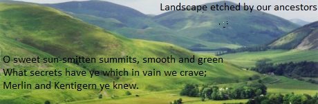
View of the Tweedsmuir Hills from the site of an iron age hillfort - a Scheduled Monument - on the summit of Whiteside Rig. The Crook Inn can be seen beside the River Tweed in trees in foreground centre right.
Insert in bottom left of image is part of a poem titled Tweedsmuir by the Rev. John Buchan 1847- 1911 (1) (Father of John Buchan - Lord Tweedsmuir.)
Some of the secrets held in these smooth and green rolling hills have been gleaned by diligent research and are presented, not very expertly, on the 70 pages or so under 24 headings listed below following this preamble and News.
The etching of the landscape was commenced by a hunter c4000 BC who dropped his broken yew bow in a peat bog, he left no other mark on the landscape. He was the descendant of groups that had srrived in the tweed valley c6500 BC. He was followed by many others who did leave very distinctive marks such as cairns, standing stones , roundhouse settlement sites, cremation cemeteries, hillforts, burnt mounds etc.
There are still many mysteries that are being investigated including the early history of Chapel Knowe the enigmatic small hill on which the present Tweedsmuir Kirk stands. The Rev. George Burns writing in 1834 in the Statistical Account remarked "that a veil of mystery hangs over it which will probably never be dispelled,"
The mound is sited at the confluence of the River Tweed/Talla Water and at the centre of a concentrated bronze age landscape spreading out to an astonishing array of numerous bronze age round house and settlement sites including a recent roundhouse discovery at the Fruid Reservoir that is under investigation and research when water levels allow. This roundhouse is very close to similar Heritage Assets at the nearby Whitehill Brae Windfarm site. The confluence and the nearby ford would be a meeting place for the local tribes and the mound was probably a burial place and religous site and had been so for many centuries. Of these Bronze Age sites many, including the hillfort on the site of Oliver Castle, have been declared as Scheduled Monuments by Historic Environment Scotland.
It is possible that the Druids were the successors to this landscape and may have continued the occupation of the mound. Another, probably associated, mystery also being investigated, is why a small hillock near the source of the River Tweed and was in the ancient Wood of Calidon is named with the grandiose title of Crown of Scotland?
However, it is the medieval familes, with their Knights and castles, such as the Frasers and Tweedies that have been better recorded in the annals of Scottish Borders history, that tend to be the best remembered. The two families intermarried on at least on two occasions and it is this connection between these families that has made the Tweedies a Sept of Clan Fraser.
But, maybe the best remembered should really be Merlin Caledonius who along with Kentigern - St Mungo c500 AD - followed by St. Cuthbert were the first recorded named persons in what is now the Parish of Tweedsmuir. The first recorded local name is that of Hunter c1000.
The earliest recorded place names in the parish, c1000 AD, are Polmood and Badlieu.
NEWS 1.
Whitelaw Brae Windfarm
June 2020. The Whitelaw Brae Windfarm that has been approved but has been stalled for many years is now progressing with new technology and larger turbines. Although there is not much we can do about the farm itself there is much to play for regarding the Heritage Assets on the site. We also have to show our envirnmental credentials by influencing habitat, wildlife and tree planting - riparian or otherwise - and access.
News. 2.
River Tweed Trail
In 2020 funding was obtained by the Tweed Forum for the implementation of the 7 year River Tweed Trail Project that is part of one of the regions most significant cultural and environmental projects. This is a shared use trail between the source of the River Tweed and the mouth of the Tweed where it enters the North Sea at Berwick on Tweed. An alternative description of the route could be from Tweedsmuir to Tweedmouth! The vision of the project is to conserve, celebrate and promote the History of the RiverTweed. A Vision Statement can be seen on the Tweed Forum website -
Tweed Forum appointed a Project Manager in June 2020. A Deputy and other staff have been appointed.
This project is huge for the Parish of Tweedsmuir that has the source of the Tweed within its bounds. This gives opportunities for enhancing not only the historical heritage but also the natural habitats and culture of the area. Also includes a variety of projects that aim to restore and enhance degraded habitats, increase climate change resilience, create pollinator corridors, encourage volunteering, and educate children and locals about the river and its management. Particularly in the vicinity of the actual source. Scroll down to first section for more about the source.
The Vision Statement mentions the Crook Inn in Tweedsmuir as an essential component of the project - scroll down to section five for more about the Crook.
The Vision Statement coins the phrase "River Tweed Trail". However a more suitable title, would be River Tweed Way. This would conform to the other walkways in the area viz. Annandale Way, Southern Upland Way, Scotways, John Buchan Way etc. The Tweed Forum has recently - June 2021 - issued a survey for completion that includes the title for the trail.
NEWS 3.
An International Conference on Merlin Fact or Fake to be hosted by Robin Crighton, Tim Clarkson and Nickolai Tolstoy to be held in Moffat has been reschuled for September 11-12th 2021. Event postponed again un til 2022.
NEWS 4
Bronze Age Find near Peebles.
In August/2020 metal detectorists discovered, near Peebles, an amazing hoard of artefacts from the Bronze Age including a sword, harness trappings and parts of a chariot. We await a formal report with interest and how this may impact on our knowledge of the Bronze Age heritage in Tweedsmuir Parish.
https://www.bbc.co.uk/news/uk-scotland-south-scotland-53714864
The fact that the hoard included articles such as a sword and chariot trappings perhaps indicate that they belonged to the Votadini tribe that occopied the hill forts of the Eastern Tweed and not of the Selgove tribe that occupied the round houses of the Upper Tweed?
NEWS 5
Oliver Field, Tweedsmuir. Woodland.
In summer of 2021 a new commercial woodland planting is planned for Tweedsmuir betwen Oliver and the site of the Crook Inn. Although mainly a commercial planting there are many broad leaved trees and some inspired riparian planting. The site also includes the Scheduled Monument of Nether Oliver Crags fort.
==================================================================_________________________________________________________________________________
1
The Sources of the River Tweed in Tweedsmuir Parish.
1a. Ancient source of the River Tweed now the longest tributary - The Corwater.

To read more click on a heading below.
Source of the River Tweed - Annan, Tweed and Clyde rise out of the same hillside.
1b Modern - since the sevententh century - source of the River Tweed at Tweedshaws.
At the layby on the A701 overlooking the source of the River Tweed at Tweedshaws is a stone monument depicting the story of the river from the source here to Berwick on the north sea. It is hoped that this area and the adjoining Earlshaugh can be substantially improved when the planned Tweed Forum River Tweed Trail part of the Destination Tweed Project commences here.
To read more click on heading below.
Tweedshaws - the Source of the River Tweed

Source of River Tweed, looking north on the A701, in rushes/reeds on right of image - not very inspiring!. Viewpoint layby and Tweedshaws Farm House just round the corner.
_____________________________________________________________
2
The Early Families of Fraser.
Th e Frasers first arrived in the Tweedsmuir area in the twelfth century and settled in. They built castles at Fruid, Oliver and Neidpath. The castle at Fruid was the first to built adjacent to the Carterhope farm and Chapel. These Frasers became the progenitors of the current highland families of Clan Fraser, Lovat Fraser and many Fraser cadet lines.
To read more click on heading below.
Oliver Castle Site of. Scheduled Monument.
Frasers of Neidpath Castle and the Yew trees of Neidpath.
Frasers and the Templars. The Battle of Roslin 1303.
Frasers and the Declaration of Arbroath. 700th anniversary 2020.
_________________________________________________________________________________________3.
3
TWEEDIE FAMILY OF OLIVER
The first Tweedie of Oliver was William Tweedie - a younger son of James Tweedie of Drumelzier - he was alive c1489 and resided at Oliver Castle. He took over from the Hays - the Hays had been there since the marriage of Mary Fraser the co-heiress of Oliver and Gilbert Hay c 1312. (In 1489 the Fraser family were still resident in Fruid and in 1525 Katherine Fraser the heiress of the Frasers of Fruid married James Tweedie of the Drumelzier Tweedies thus further connecting the Tweedies with the Frasers.)

To read more click on heading below.
Bield. (Part of Oliver Estate).
Halfway House. (Halfway between Oliver & Crookhaugh)
________________________________________________________________________
4
EARLY PEOPLES.
 To read more click on heading below.
Pre History Bronze Age - Cists, Cairns, Enclosures Round Houses.
Map - Iron Age Scotland from 800BC.
Standing Stone Circles. Bronze Age followed by Druids.
Standing Stone Features. Meggat Stone, Gameshope Stone etc.
Bronze Age Round Houses.Article by Tam Ward, Biggar Archaeology Group.
Woodend Bronze Age Cemetery. Report by Tam Ward, Biggar Archaeology Group.
( The small heritage trail mentioned in the last paragraph of the report has come to fruituition in Nov/2020)
Logan Archaeology. Report by Tam Ward, Biggar Archaeology Group.
Chapel Knowe The enigmatic mound on which the present Kirk stands.
Romans. Ericstanebrae gold fibula.
_______________________________________________________________________________________________________
5
CROOK INN

The Crook inn dates back to 1604 and was one of the first licensed premises in Scotland. It has a stirring history and much of the history of Scotland has passed its doors. Many literary giants of the Scottish Enlightment enjoyed the hospitality of the Inn. It is listed by H.E.S as category C. The listing is because of the Art Deco features such as the windows shown on image on left also an Art Deco garden. Sadly the Inn was closed and was under threat from developers to convert the property into flats. However, the local community stepped in and managed to buy the property after years of neglect. It is now under development as a formal Community Hub a function that it had provided for many years prior to closure.
To read more click on heading below.
Crook Inn History
Scottish Enlightenment. Walter Scott, Robert Burns etc. at the Crook.
Willie Wastle's Wife. Poem by Robert Burns about Willie Wastle who resided at Linkcumdodie.
Maclaren's Leap. Escape of Donald Maclaren at the Devil's Beeftub. Also known as Maclaurin.
___________________________________________________________________________________
6
TWEED BRIDGES.

The River Tweed where it is wider nearer it's mouth has several majestic multi arched stone bridges. However here nearer the source the bridges are much smaller but still have stories to tell. More about the Talla railway/reservoir below in Section 7.
To read more click on heading below.
Carlow's Bridge - Listed Cat. B.
Polmood Bridge - Listed Cat C.

_____________________________________________________________________________________________________________________________
7
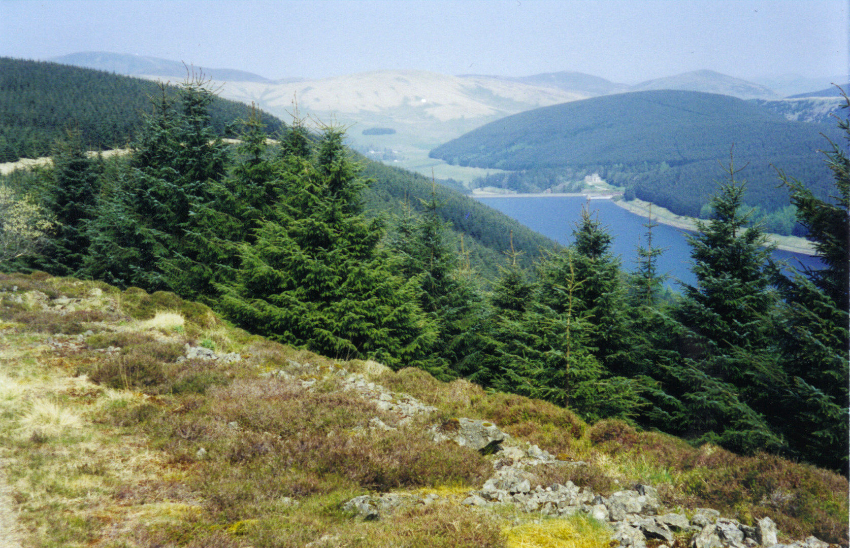
TALLA RESERVOIR AND RAILWAY.

The Talla reservoir was constructed between 1895-1905. This was to provide water to Edinburgh via an aquaduct that was also part of the project. A service railway was built between the existing railway station in Broughton and dam to bring workers and materials to the site. The project was bedeviled by delays, rumours of drunkeness and many industrial fatalities. An outbreak of smallpox in Scotland was traced to the site. A fine house was also built as an HQ for the Edinburgh Water Works company and residence for the site Managers named Victoria Lodge.
To read more click on heading below.
Talla Reservoir & Railway. General
Puddle Clay Trains Hudswell Clark 0-4-4T Locomotive.
Level Crossing at Kingledores.
_________________________________________________________________________________________
8
Ericstanebrae.
The Ericstanebrae layby is on the A701 road just north of the town of Moffat in Dumfriesshire. The King Robert the Bruce Trail.

To read more click on heading below.
__________________________________________________________________________________________
9
Hunter Family of Polmood.
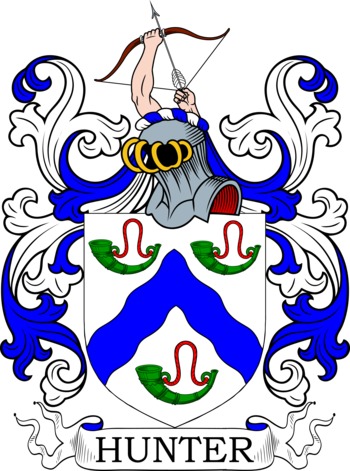
The first, with the name of Hunter, came to the area in the eleventh century and established a Hunter family at Polmood in parallel with the Hunter family of Hunterstoun - the chiefly line of Clan Hunter. The family remained at Polmood until the nineteenth century when the lands were sold and the line came to an end.
To read more click on heading below.
Capture of Sir John Murray at Polmood.
________________________________________________________________________________________
10
WELSH FAMILY OF TWEEDSMUIR
Members of the Welsh family were well established in the area when the Parish of Tweedsmuir was formed in 1644. They were heavily involved in the subsequent Covenanting era. The family is well represented by brass wall mounted plaques in the Tweedsmuir Kirk. On the plaque listing all the Ministers since 1644 is the Rev. James Welsh of Menzion, Minister 1721-1755. The Rev. David Welsh DD Founder of the Free Church of Scotland in 1843 is remembered on another plaque. There are two other plaques remembering two cousins, both Tom Welsh, who died in WW1.
To read more click on heading below.
Welsh of Tweedsmuir. (Includes family tree.)
Tweedsmuir Parish Kirk 1874-Present. (Wall Plaques)
_____________________________________________________________________________________
11
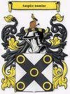
PORTEOUS FAMILY OF HAWKSHAW.
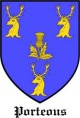
The Porteous family were resident at Hawkshaws in the Fruid valley since the fifteenth century and remained there for three centuries. They built a castle there - Hawkshaw Castle - of which the remnants are still evident and is the seat of Clan Porteous - it is a Scheduled Monument. In recent times the Porteous Clan have built a memorial on the site.
To read more click on heading below.
_____________________________________________________________________________________
12
HAY FAMILY OF TALLA.

The Hays inherited part of the Barony of Oliver with the marriage of Gilbert Hay to the Heiress Mary Fraser c1312. Part of these lands was the Talla valley where the summer residence, known as Tallashiels was located. This was first owned by the Frasers then by the Hays of Oliver Castle. A cadet line of the Hays styled themselves as Hay of Talla.
To read more click heading below.
Hay of Talla. Includes Hay family of Nether Menzion.
_____________________________________________________________________________________
13
CHISHOLM/E FAMILY OF TWEEDSMUIR.
The Chisholmes were established in Tweedsmuir where they were recorded in 1639. However by 1700 they had vanished from the Tweedsmuir records. What happened to them and where did they go?
To read more click on heading below.
____________________________________________________________________________________
14
JOHN BUCHAN (1875-1941) First Lord Tweedsmuir.

John Buchan was born in Perth, Scotland. He was a diplomat, barrister, journalist, historian, poet, Member of Parliament, and novelist. It is probably the last of these attributes for which he is remembered - namely the author of the novel The Thirty Nine Steps. Buchan knew the Scottish Border landscape - he knew every burn and dry-stane dyke and the area featured in many of his novels. The locations are not actually identified but there are enough clues and pointers to indicate where the action is taking place. This include The Thirty Nine Steps where Galloway and Upper Tweed including the area around the source of the River Tweed are featured. He took the title of Lord Tweedsmuir in 1935 when he was appointed as Governor General of Canada.
To read more click on heading below.
John Buchan Lord Tweedsmuir - Life and Works.
______________________________________________________________________________________________

15
Rev. W. S. Crocket. D.D. (1866-1945)
The Rev. Crockett was Minister of the Tweedsmuir Parish between 1894 and 1945. He was the second last Minister in the post and second last occupant of the manse before it became a private residence.
To read more click on heading below.
Rev. William Shillinglaw Crocket
______________________________________________________________________________________
16
THE COVENANTERS

To read more click on heading below.
Tweedsmuir and the Covenanters
Tweedsmuir Trial and citations.
_________________________________________________________________________________________________________________
17
THE PILGRIM'S WAY & SPREAD OF CHRISTIANITY IN UPPER TWEED.
A pathway through the Parish of Tweedsmuir from south to north was commenced by Pagan sun worshippers. Followed by Druids such as Merlin then by Christians like St Kentigern (Mungo) and St Cuthbert. The Presbyterian faith was embraced and the new Parish of Tweedsmuir was formed. The area became a hotbed of Covenanting activity. At this time the first recorded Kirk was built on Chapel Knowe in 1644 with a subsequent replacement second Kirk in 1874.
To read more click on heading below.
The Pilgrim's Way. Merlin & St. Kentigern (Mungo).
Tweeds Cross. Boundary and Way Marker
Fruid Chapel. Burial Ground.
Tweedsmuir Covenanter Trial and Subsequent Citations.
Chapel Knowe. The enigmatic mound on which the Kirks were built
Tweedsmuir first Kirk 1648-1874.
Tweedsmuir Second Kirk 1874-Present.
Tweedsmuir War Memorial. (in entrance hall of Kirk)
Tweedie Armorial Plaque. Carved Stone Slab.
Symbolic spy-hole in Kirk door.
________________________________________________________________________________________
18
HOPECARTON & CARTERHOPE THE VALLEYS OF THE CARTS - THE MONKS OF MELROSE & THE WOOL TRADE WITH FLANDERS.
The Cistercian Monks of Melrose arrived in the 13th century and set up a very prosperous hill sheep farming industry spread over the Tweedsmuir Hills based at Hopecarton. They exported the wool and fleeces to Flanders via the wool market in Roxburgh where the wool/fleeces were taken by horse drawn carts thence to Berwick for export.
To read more click on heading below.
Hopecarton & Carterhope. Monks of Melrose
_____________________________________________________________________________________
19
Other well sites in Tweedsmuir.
Other recorded wells in Tweedsmuir Parish.
On mid nineteenth century Ordnance Survey maps of Tweedsmuir parish there are several draw wells shown, rather surprisingly they were shown adjacent to water ways. One of these wells as indicated above was at the source of the river Tweed – in fact the source of the river is still known as Tweedswell. There is also a Marchwell in the Fruid valley and a well at Forkfoots which is at the confluence of the Glenrusco and Westerhope burns The reason for these wells must indicate that there was a severe drought at some time. The records are not great on drought but they are on spates when bridges etc were carried away. A good supply of water was very important for the watering of the very large flocks of sheep kept at the hill-farms in the area and also for the washing of the fleeces. This requirement maybe going back to the Monks of Melrose in the thirteenth/fourteenth centuries who had huge flocks spread over the Tweedsmuir Hills.
John Buchan in his early novel titled John Burnet of Barns(2) mentions a drought in 1683 when the Manor Water dried up and the river Tweed at Manor was just a trickle. If the Tweed at Manor was a trickle it would have been dried up in Tweedsmuir. Using a fictional novel to justify history is not good practice but John Buchan did a prodigious amount of research for his historical stories and of course he could call on his brother James Walter Buchan the author of the 3 volume History of Peeblesshire for assistance.
There was a the book published in 1911 titled Highways & Byways in the Border(3) by Andrew and John Lang. The book included many fine illustrations of the Upper Tweed area by Hugh Thomson. Mr Thomson was obliged to add a note at the beginning of the book - this reads The artist wishes to call attention to the fact that his drawings were made during the long drought of 1911, when all the rivers were exceptionally low.
Assuming that there was a drought resulting in the river Tweed drying up it does suggest that Global Warming is not something new!
References.
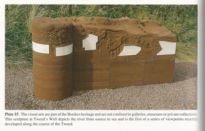
1) Dent, John & McDonald, Rory; Heritage Sites in the Borders, Scottish Borders Council, 2001. p73 and plate 15.
2) Buchan, John; John Burnet of Barns - Unified Edition, Nelson, Edinburgh, 1927. p34.
3) Lang, Andrew and John; Highways & Byways in the Border, McMillan, London, 1913. Frontispiece Note.
_______________________________________________________________________________
20
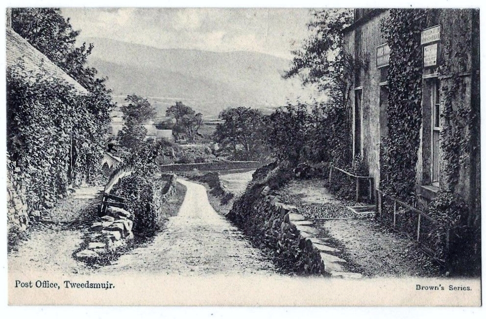
POSTAL SERVICES IN TWEEDSMUIR.
To read more click on heading below.
Old Post Offices in Tweedsmuir.
Postie Stone. Mail Coach Monument.
______________________________________________________________________________________
21
JUBILEE ROAD.
The Jubilee road was constructed in 1977 by the Forestry Commission as an eight mile forest drive through recently planted sitka spruce plantation.
To read more click on heading below.
____________________________________________________________________________________________
22
Bonnie Bertha of Badlieu
 The farm of Badlieu, is sited a few miles north of the current Source of the River Tweed and is the earliest recorded place name in Tweedsmuir Parish. It is remembered as the home of Bonnie Bertha of Badlieu
Painting above of Badlieu by Andrew Lorimer (1906-1996)
To read more click on heading below
_____________________________________________________________________________
23
MISCELLANEOUS ITEMS OF INTEREST.
To read more click on heading below.
Destruction of Archaeology Sites.
Great Plague of 1645 in Upper Tweed.
Formal Walled Gardens of Tweedsmuir.
Saw Pits in Tweedsmuir Village in 1855.
_______________________________________________________________________________________
24
References/Bibliography for Tweedsmuir Parish History
_________________________________________________________________________________________
References.
1) Buchan, John, Rev; Tweedside Echos Moorland Musings, John Mclaren, Edin 1881. Poem titled "Tweedsmuir" p22.
The Royal Commission on the Ancient Monuments of Scotland (RCAHMS) and Historic Scotland (HS) combined in 2015 to form a new organisation Historic Environment Scotlanf (HES). The references in the above pages to the RCAHMS and HS should now be read as H.E.S. The online archive "Canmore" www.canmore.org.uk continues/expanding and the relevant site ID numbers from Canmore are included on the above pages.
Also in 2016 the National Archives of Scotland - NAS - rebranded themselves as the National Records of Scotland - NRS.